Showing Posts From
Hiking
- Taylor Courier
- 13 Sep, 2026
Arizona White Mountains, Labor Day Weekend
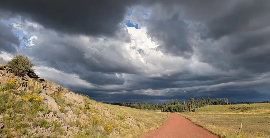
Last weekend was the Labor Day long weekend, and I took a road trip to the White Mountains from Saturday through Monday. Saturday: Greer and the climb to camp I got a late start and drove up through Payson, then through Show Low and Pinetop-Lakeside, before dropping down into Greer — the highest town in the state at 8,400 feet. From there I did a short hike from the Government Springs Trailhead along the West Fork Little Colorado River: scenic mountain and river views, a few wildflowers, and a welcome change from the Phoenix desert heat.From Greer I passed through Eagar and turned onto a winding dirt road past the Sipe White Mountain Wildlife Area, searching for a dispersed campsite. I kept going up the road toward the Escudilla Lookout Trailhead, climbing to 9,800 feet, where I camped along a forest road while cows ambled by.Sunday: Escudilla Mountain The next morning I drove the few remaining miles to the trailhead, surprised to find only two cars there at 9 a.m. on a holiday weekend. I started up toward the summit of Escudilla Mountain — the third-highest peak in Arizona, sitting about 3.5 miles from the New Mexico border. The mountain was hit hard by the 2011 Wallow Fire, which burned 538,049 acres, including the cab structure of the fire lookout at the summit. The tower itself still stands, and looks mostly intact from a distance — but the cab at the top is missing its floor and interior, with only a few melted solar panels left behind.On the entire hike I only passed four groups totaling 11 people, and had the summit and the entire top half of the trail to myself. Hike stats: 6 miles round trip, ~1,500' elevation gain.After the hike, I continued driving south on the Coronado Trail, passing through Hannagan Meadow and reaching the Blue Vista Scenic Overlook, which looks south over the edge of the White Mountains toward the Blue Range Primitive Area. That was my turnaround point — the rest of the Coronado Trail, with its hundreds of curves, will have to wait for another trip.I camped the second night just south of Big Lake, at a dispersed site overlooking the canyon of the West Fork Black River. As sunset approached, the light was phenomenal — an orange glow against dark, threatening storm clouds. Soon after I set up my tent, the rain arrived. I made a quick trip back to the lake and ended up waiting out the hardest rainstorm I've seen in a while, sitting in the car. When I got back to camp, the spot where my car had been parked earlier was still bone dry. Microclimates.Monday: the long way home The next day I passed Big Lake again and stopped for a short walk where an old railroad grade has been turned into a trail. A pedestrian bridge now replaces the missing trestle over a small creek and rocky canyon, and wildflowers were abundant along the way.After a quick pass by the Sunrise ski area (one of only three in Arizona), I headed home via a loop through the Fort Apache Reservation, through Canyon Day, then onto US 60 through Globe, stopping at the Salt River Canyon. The highway zigzags several thousand feet to cross the river, and at the bottom there's a rest area with stairs down to a river viewpoint, plus the option to walk across the old highway bridge.
- Taylor Courier
- 14 Dec, 2025
Looking Glass Rock — Pisgah National Forest
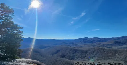
December 12, 2025 A warm, clear day in the middle of December is reason enough to head into the woods—especially when it’s a brief gift between cold fronts, and a sharp contrast to winter back home in Washington. Looking Glass Rock rises above Pisgah National Forest as a broad granite dome, reached by a steady climb through forest before the trail steepens and spills out onto bare stone. The first miles pass gently, the last half mile rocky and rooted, pulling you upward toward open sky. It was cold at the trailhead, but the sun worked quickly. By late morning I was hiking in a t-shirt, something that still felt faintly improbable for December. I passed a couple dozen people on the way up, all clearly drawn out by the same rare weather window before temperatures dropped hard overnight.The summit opens in every direction. Layers of forest stretch toward the Blue Ridge Parkway, with John Rock visible across the valley. I sat in the sun longer than planned, eating a sandwich and letting the warmth linger. The kind of pause that feels earned. Just before reaching the top, I crossed paths with another hiker carrying a camera. The conversation began the usual way—what are you shooting with? Nikon and Canon, respectively—followed by the expected, joking expressions of brand loyalty. From there, it unfolded easily. We talked about photography, hiking, astrophotography, and the shared feeling that time outside is less a hobby than a necessity.We stayed on the summit talking for an hour, then walked much of the way back down together. We spoke about risk, solitude, and the ways we both tend to wander—often alone—into places like this. It was an easy, unforced connection, one that didn’t ask to be anything more than what it was. At the trailhead, we parted without exchanging plans, and that felt exactly right. There were few visible impacts from recent storms along this trail, though nearby roads still show the marks of Hurricane Helene. Along the forest road, a large prescribed burn has left the ground and lower trunks charred—a stark sight now, but one that will hopefully reduce the severity of future fires.I didn’t take many photographs on this hike. A handful stood out—broad views from the summit, looking in different directions, each carrying a slightly different light and mood. Sometimes that’s enough.